Showing posts with label Melville Cove. Show all posts

Tuesday, May 31, 2011

HRM Bike Week 2011, Part 2: Bike & Boat

On Tuesday, one of the most anticipated events of the week (on my part, anyway) was happening, and I could barely wait.


(I'm not used to seeing a full bicycle rack.)


(Apparently neither was the boat club. Here you can see bikes locked to fences and trees, and if you look closely, you can see that the fence way back in the distance has bikes locked to it too.)

The reason there were so many bicycles parked outside of the St. Mary's Boat Club on this day, is because people who rode their bicycles were able to paddle a canoe or kayak for an entire hour, and/or join a group yoga session, for free. This was a marvelelous idea for a few reasons: A) It involves bicycles (enough said), B) look at how many people showed up - it was obviously a success, and C) Nobody in Halifax seems to even knows that this place exists. Most of the staff who work at the facility only found out about it through past HRM Bike Week Bike & Boat events.

St. Mary's Boat Club is actually a municipally subsidised facility in a prime location on the Northwest Arm. It provides an inexpensive recreation experience to the entire population of HRM for less than the cost of going to the a movie. Twice a week during the summer, the Club provides group canoe and kayaking sessions, and you can even take lessons on how to sail.


(On this day, it was going to be kayaking for me, and from the above image, you can see that most of the other visitors were interested in paddling in a kayak as well.)

Our friendly, neighbourhood instructor-man, Steve, helped us get into the kayaks safely (read: dryly). However, I decided to get a bit of practice in on the dock first.


(Hey, who's that good-lookin' guy in the blue kayak? He looks like he can really paddle.)

After an hour we finally were able to get everyone into the water and were on our way around the Arm.

The Northwest Arm is one of the most beautiful and interesting areas in Halifax, if not Nova Scotia. In and around it you can find trails, National Historic Sites, towers, parks, monuments, homes of rich people, and even dead American soldiers.


(Some of the houses, like that one behind me, cost upward of $900 000. Here I paddle past and steal some of its attention. My apologies to the owner. Special thanks to my new friend Brent who teamed up with me to perform a daring boat to boat transfer of my camera before taking these shots.)


(Lest you think St. Mary's Boat Club only offers kayaking, I provide this picture as proof that canoes can also be rented. In hindsight, canoeing is far more relaxing than kayaking - it's just far too tempting for me to try and make my kayak go fast.)

Towards the end of our session, we congregated in Melville's Cove to hear a bit of history. Long-time readers of EPTN (and those who clicked on the above links) will know that Melville's Island used to be a prison during the War of 1812. The soldiers would shoot across the cove to a small peninsula they called Target Island (the Brits at that time seemed incapable of distinguishing peninsulas from islands). Many years later it was discovered that there were dead American prisoners of war burried on the "island." But now you get to hear "the rest of the story."

Because of the American policy of "leave no man behind," The United States of America proposed that some soil be brought up across the border, spread over the ground, and Target Island be named American territory. Well, the leaders of Halifax are capable of making at least one good decision, and they figured it wasn't such a good idea to have a bit of the U.S.A right in the middle of Halifax. Instead, it was agreed upon that the area be named a park, and a monument was placed there with the names of all the soldiers. Every year on the last Monday of May (the day before this day, incidentally), a Memorial Day celebration honouring the soldiers is held on the renamed Deadman's Island.


(One of our guides exhibits proper boating safety, as he recounts the history of Deadman's Island, and tells a story about how he and some other instructors told the students at a summer camp that the area was haunted with the ghosts of the buried American. The students were told the ghosts became bald eagles, which nest around the Northwest Arm. One day the students came screaming down from a hill, and a bald eagle was chasing them. 10 of the 11 children ran and hid, but one brave little girl grabbed a mini-oar, about three feet long, and started waving it in the air to defend the canoe. It sounds like she's got what it takes to be the next EP. From here on, I will refer to her as "EP Girl.")

Friday, July 30, 2010

EP Bike Trip #1: Crystal Crescent Beach

Welcome to a new feature on Ea-Pea Dave's Terra Nova: the EP Bike Trip.

As I may or may not have been clear about in my FAQ section, I do not own a vehicle and so I ride one of my two bicycles to nearly every single one of the Points of Interest, Monuments and Festivals/Events that you read about on my website. However, Nova Scotia is not just Halifax (believe it or not), and so at some point I knew I would have to venture out to bring you more great historic sites, interesting places and/or festivals. While there will definitely be situations in which renting a car will be most appropriate, for a good portion of these places I hope to be able to make a solo trip using, you guessed it, my bicycle (I may yet attempt to move a mattress or transport a Christmas tree using my bicycle just to prove it can be done).

Since I have been on and plan to go on many more long bicycle rides, for the purposes of this section an EP Bike Trip will be classified as any trip in which the total distance travelled is over 50 km, and there is a specific purpose for taking the trip (i.e., to visit a certain place or attend a certain festival).

With that introduction, let there be no more further ado. EP Dave is pleased to present to you his first ever EP Dave Bike Trip to Crystal Crescent Beach (be sure to have your Google Maps ready so that you can follow along).

My journey started, as all my journeys do, at my house in the centre of Halifax. I travelled south, around the North West Arm, via the Armdale Rotary, and then up Herring Cove Road to Spryfield. Just past the Canadian Tire, I turned right onto Sussex Street and continued on Old Sambro Raod, through Long Lake Provincial Park, until I came to Doyle's Lake (between Harrietsfield and Williamswood).


Doyle's Lake is really not much more than a large swamp, but all the green plants growing in it made some unique patterns in the dark blue water. It also provided an opportunity for me to squat on the shoulder of the highway, refill my water bottle, and eat some blueberries I had packed for myself. Unlike Alberta highways though, the Nova Scotia highways I've seen so far don't really have shoulders. As a result, I was never more than two metres away from any of the whizzing vehicles that passed by me while I ate and rested.


By this time I had been travelling for nearly an hour, and about fifteen minutes later I was starting to feel fatigued. I had no idea where I was at this time, but when I came to Grand Lake (above) I could sense that I must be getting close.

A few minutes later I reached Old Sambro, where I turned right onto West Pennant Road, followed by a left onto East Pennant Road, and then another quick left onto Sambro Creek Drive. I followed Sambro Creek Drive along until I came to the gravel road at the end which led to the parking lot of Crystal Crescent Beach (Coote Cove, if you're looking on your maps right now).


As you can see from the pictures above, the sky could not have been more clear, which apparently is rare for this part of Nova Scotia. Not having brought a towel along though, I found a nice large rock on which to sit down and ate my lunch.

After not waiting the requisite 30 minutes, I went for a "swim" in the lake. However, upon touching my toe to the water my body immediately went "staticy" and then clenched up in right angles. I then dropped over dead from my cramps (just like in the cartoons!) After I had recovered, I waded out to about armpit height before quickly returning. It may have been hot on the beach, but it was ice cold in the water. Nonetheless, I could say I had swam in the Atlantic Ocean.

I climbed back onto my rock seat where I sunned my pasty white torso until I had dried off sufficiently to put back on my socks and shirt. I then headed back out on the road for the rest of the return loop, which would actually be ten kilometres longer than the trip to the beach.

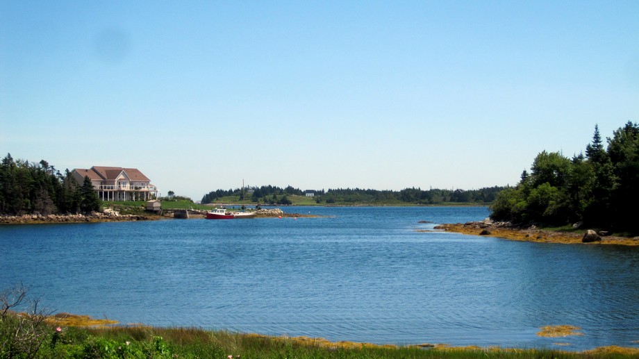
I knew I would fatigue quickly on the trip back home, having already travelled some 25 km and still having 35 km to go, so I stopped in at the Kwik Way convenience store at the corner of West Pennant Road and Ketch Harbour Road (Mr. Mishoo's Take Out on your map), to stock up on a single Snickers bar and to treat myself to a scoop of blue berries and cream Farmer's ice cream. I also made sure to stop at the beautiful Little Cairn Cove, alongside West Pennant Road, again for some more pictures (below).


After 15 km of scenic cycling along Ketch Harbour Road I came to Herring Cove (below), where I stopped to refuel on my aforementioned Snickers bar.


After a fifteen minute rest it was back on the bike to tackle the hilly Purcell's Cove Road, past the picturesque Purcell's Cove, with its equally lovely Spectacle Island, and then on to Halifax.


After passing York Redoubt National Historic Site (about which I will soon be posting), I finally limped in to Melville Cove, where I dismounted and enjoyed a waterfront stroll along the Northwest Arm, before finishing the last few kilometres to my home.

Total Distance: Roughly 60 km.